Historical Weather and Current River Information
HADS links updated 2/20/2017
|
Historical Weather Information |
|
|
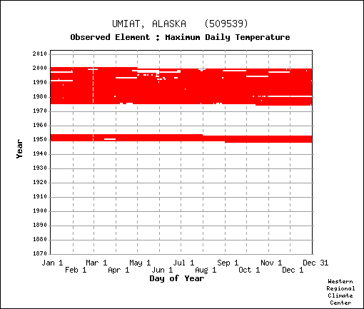
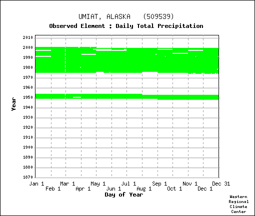
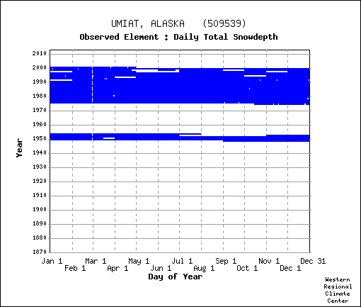
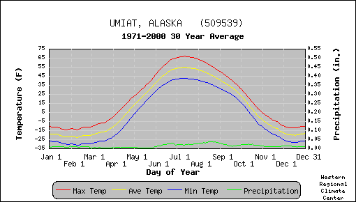
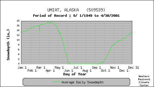
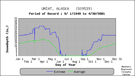
WRCC Umiat Airport period of record: temp - precip - snow
|
|
|
other weather and river info |
|
| 1995 Umiat Hydrogeological Conditions FAA report (4.2 mb) | |
| Ikpikpuk gage weather 2003 2004 2005 2006 2007 summary | |
| Fish Ck gage weather 2003 2004 2005 2006 2007 summary | |
| Colville R weather 2003 2004 2005 2006 2007 summary | |
| 2003-07 Fish/Ikpikpuk/Colville Precip Report pdf doc summary | |
| 2003-08 Fish/Ikpikpuk/Colville/Meade Precip xls |
|
North Slope River Gauges and weather |
||||
| All gages report GHT, some report additional weather sensors | ||||
| North Slope River Forecast | ||||
| Regional River Selections | UAF icewater | |||
| Colville River at Umiat | AT,WT,PCP rating |
|||
| Colville R at Colville Village | 2012 leading edge | NA |
NA |
|
| Ikpikpuk River bl Fry Creek | AT,WT,PCP,WS,WD |
|||
| Meade River at Atqasuk | AT,WT,PCP |
|||
| Ublutuoch River nr Nuiqsut | AT,WT |
|||
| Fish Creek nr Nuiqsut | AT,WT,PCP,WS,WD |
|||
| Judy Creek Mile 7 nr Nuiqsut | AT,WT |
|||
| Otuk Creek at Ivotuk | AT,WT,PCP,WS,WD |
|||
| Seabee Creek | WT |
|||
| Prince Creek | AT,WT |
HADS | ||
| Kuparuk River nr Deadhorse | ||||
| HulaHula River nr Kaktovik | AT,WT,PCP |
|||
| AECOM Inigok Tower | 3275A78E chk |
|||
| Sagavanirktok R nr PS 3 | AT |
|||
| Atigun River nr Pump Sta 4 | AT,PCP |
|||
| Imnavait Creek nr Toolik | ||||
| Putuligayuk R nr Deadhorse | ivo 1E272601 | |||
| umt 1D43C301 | igk 1E274901 | Band | ||
Missing your favorite link? Any additions are welcome! |